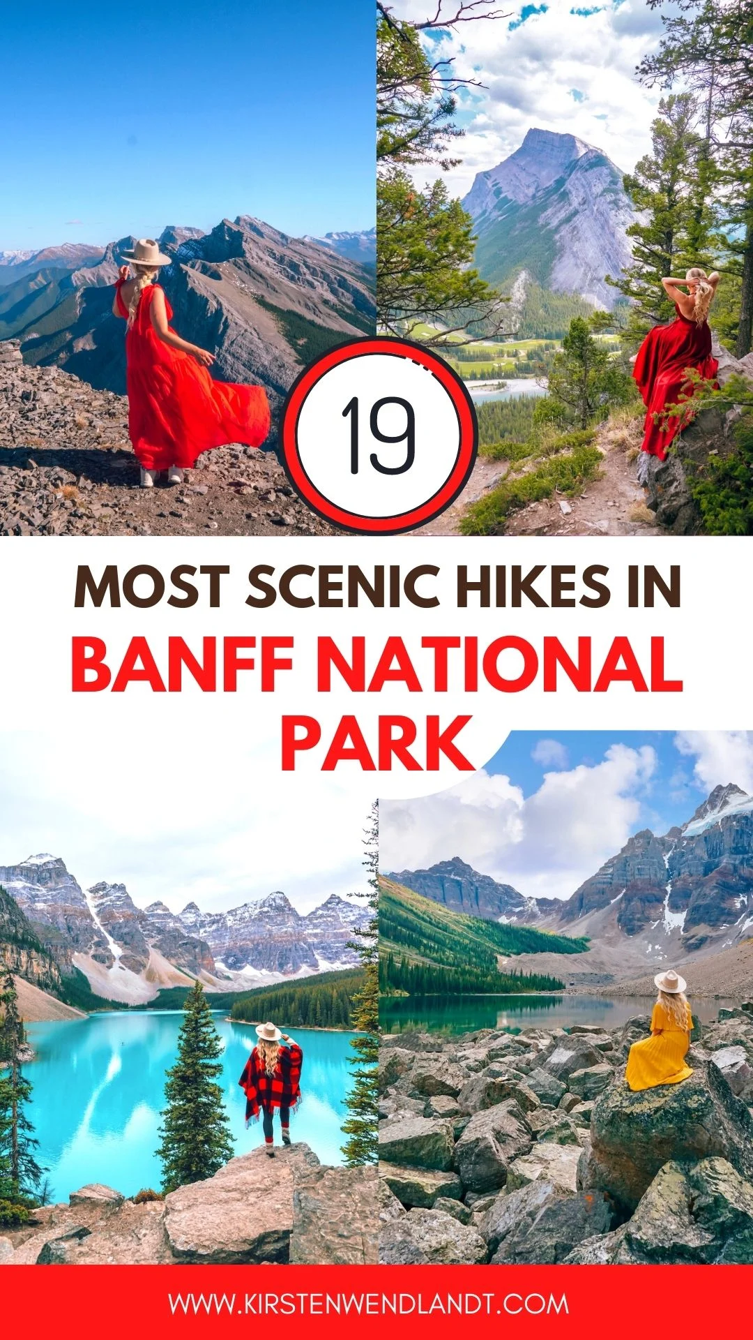
What are the best hikes in Banff National Park?
Banff National Park has some pretty incredible hikes.
In fact, did you know that there are 150 hard trails in Banff National Park?
With those kinds of numbers of course it can be difficult to narrow down exactly which hike you want to do when visiting Banff.
To make things easier for you I’ve combined this list of some of the best hikes in Banff National Park and I’ve divided them by skill level.
Before we get started, if you’re visiting the Canadian Rockies soon you might want to check out these posts:
- 50 Best Things to do in Banff National Park
- The Ultimate Guide to Hiking Johnston Canyon in Winter
- 28 Awesome Things to do in Banff in Winter
- The Best Restaurants in Banff
- 11 Best Hikes in Jasper National Park
- 23 Best Things to do in Jasper National Park
Now onto the list of the best hikes in Banff National Park!
Best Easy Hikes in Banff National Park
Moraine Lake Rock Pile Trail (also called Moraine Lake Viewpoint)
Total distance: 0.8 km loop
The Moraine Lake Rockpile trail is a short 0.8 km heavily trafficked loop that’s good for all ages and skill levels.
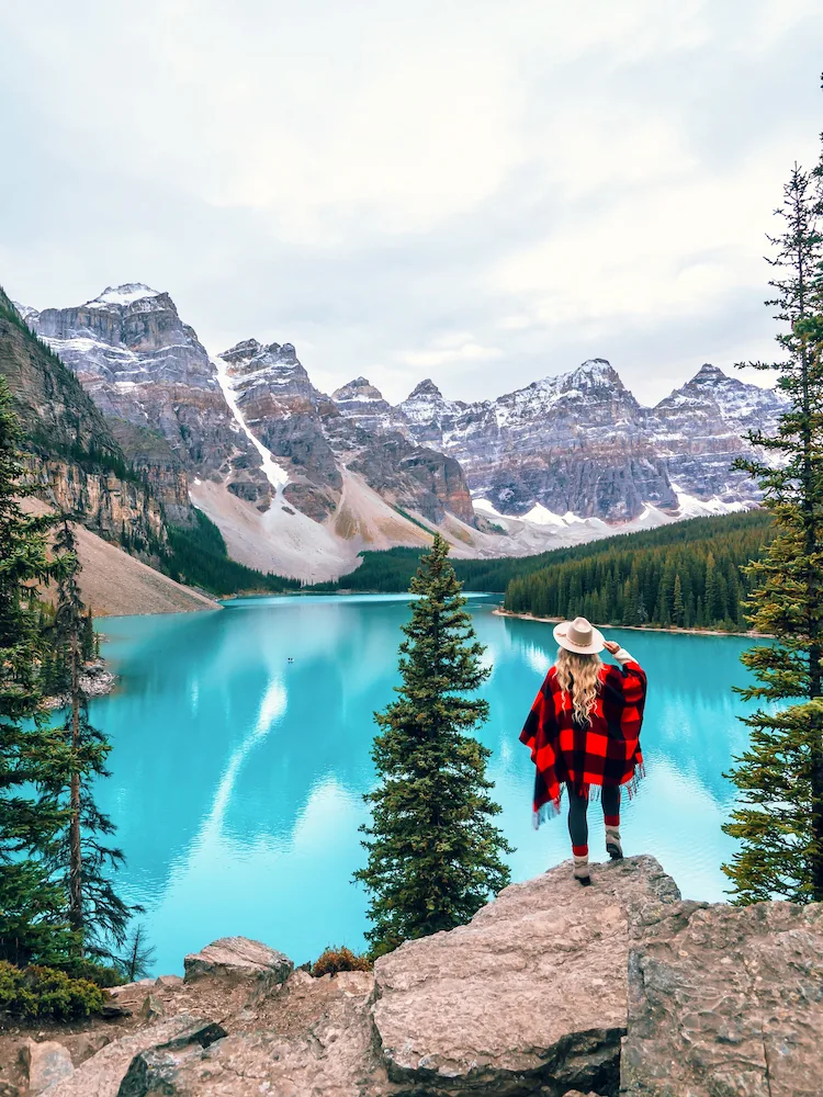
The Rockpile trail will take you to the most breathtaking views of Moraine Lake.
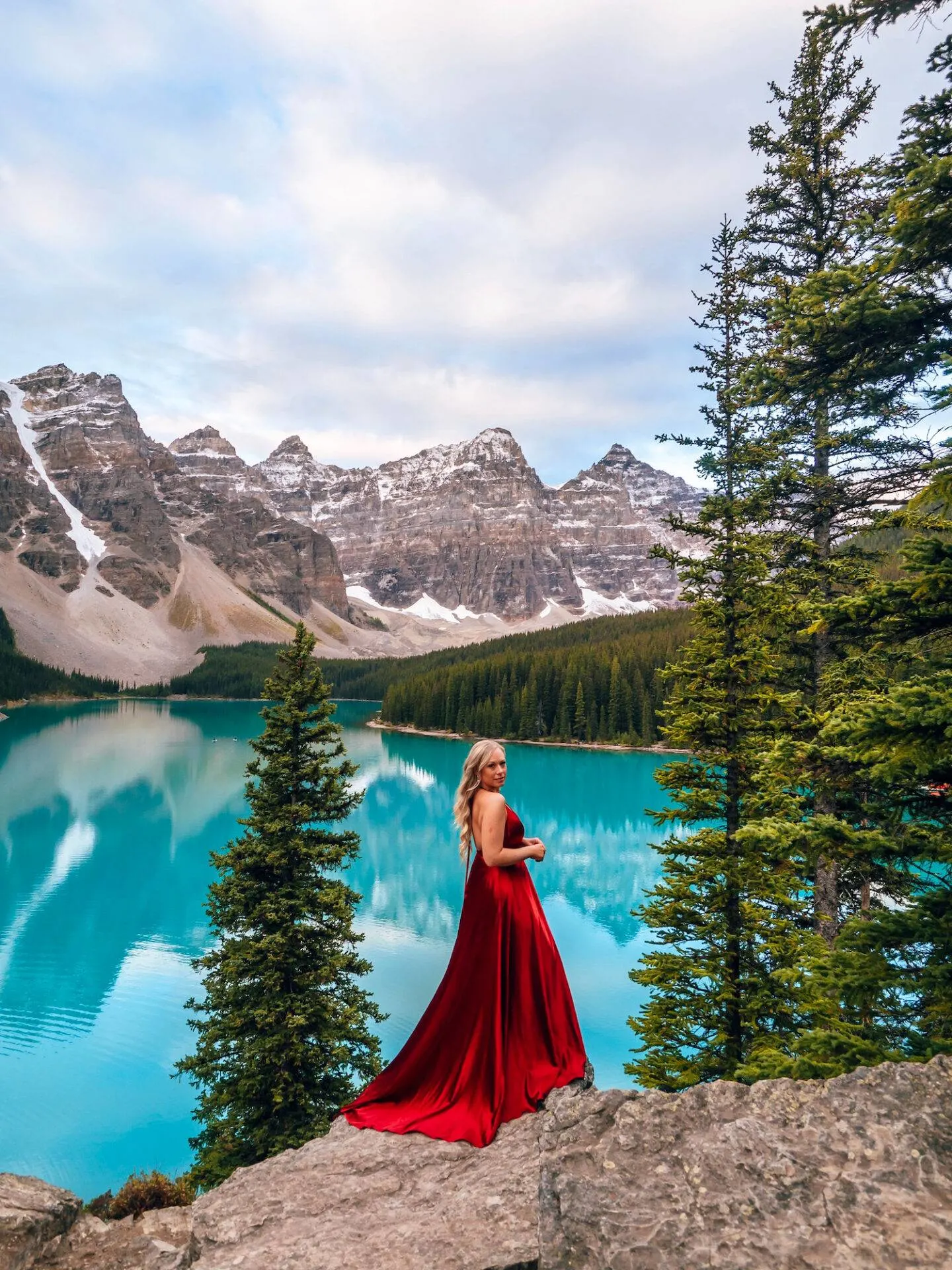
The rock pile is where most Moraine Lake photos you’ve seen online are shot.
This is the trail you will take before sunrise and then you can wait on the rock pile for sunrise.
Since this spot is so famous and is one of the most photographed places in Canada, expect to arrive early to stake out your spot.
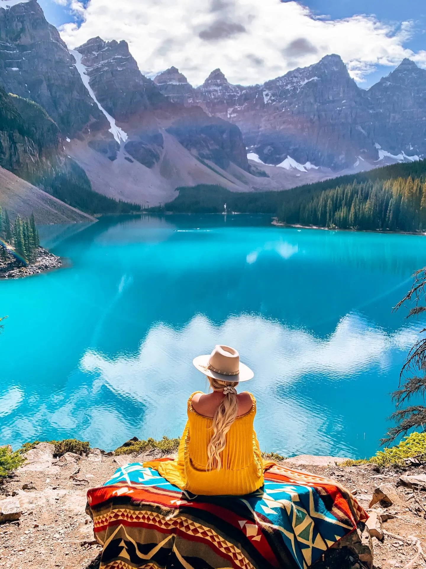
By the way can you believe the luck I got with the rainbow lens flare in the above photo? I couldn’t believe it!
Moraine Lake Shoreline Trail
Total Distance: 5.1 km out and back
The Moraine Lake Shoreline trail is a 5 km hike that’s rated as easy.
You won’t find any difficult uphill climbs on this one so enjoy – hikes like this are rare in the rockies!
The shoreline trail will take you along the shoreline of Moraine lake and it’s a great opportunity to see the lake from a different angle.
If you’re like me you’re going to want to spend the entire day marvelling at the beauty of Moraine lake, so it’s worth doing all the hikes in the area like I did!
Consolation Lakes Trail
Total Distance: 5.8 km out and back
Consolation Lakes is a short hike from Moraine and it’s 100% worth visiting.
I went there based on a recommendation from a friend and I’m so glad I did.
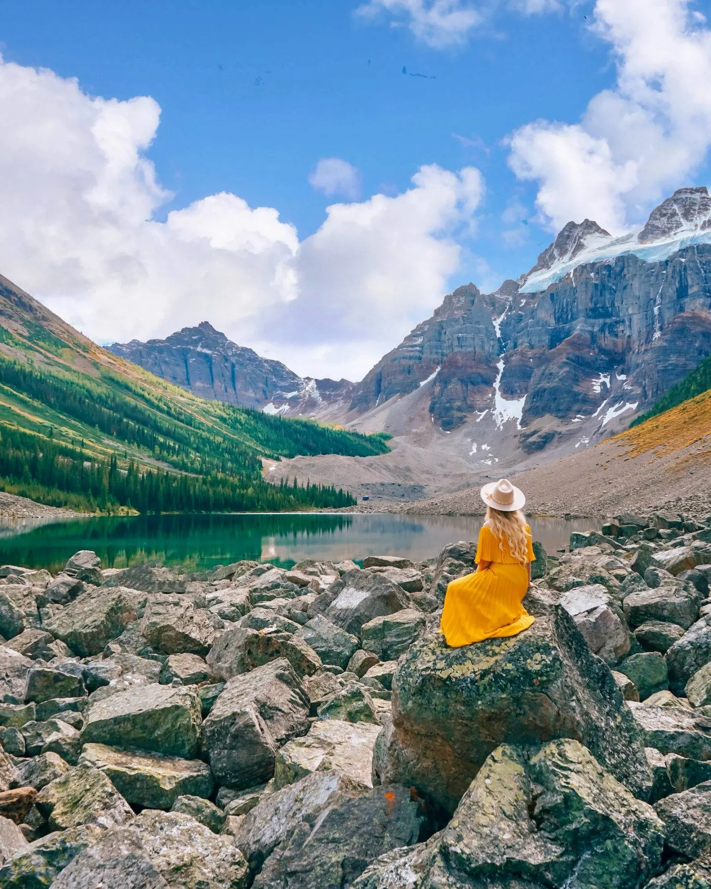
The Consolation Lakes hike is a 5.8km (round trip) hike that’s easy enough for all ages and skill levels.
At the end of the trail you’ll arrive at a rock pile which you can climb over to get to the beautiful lake.
We saw some pretty stunning reflections in the lake and I love the contrast between the lake and all the rocks.
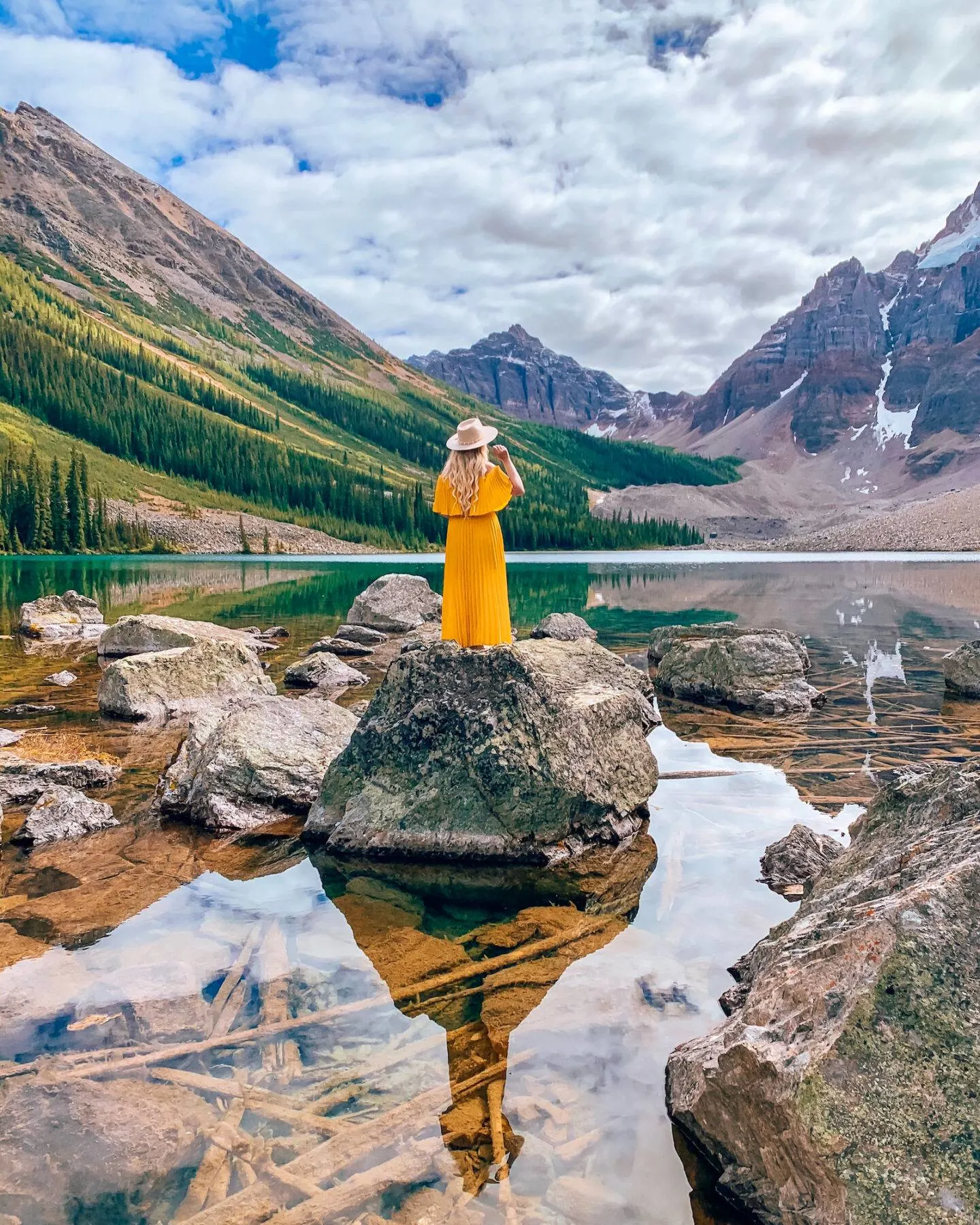
There is also a waterfall along the way so make sure you take the small detour to see that!
Bow Falls Viewpoint
Total Distance: 2.7 km out and back
Bow Falls are located just below the Fairmont Banff Springs Hotel and are a very easy waterfall to visit.
The trail for Bow Falls is just 2.7km long and is good for all skill levels so it’s an easy hike to do with the family.
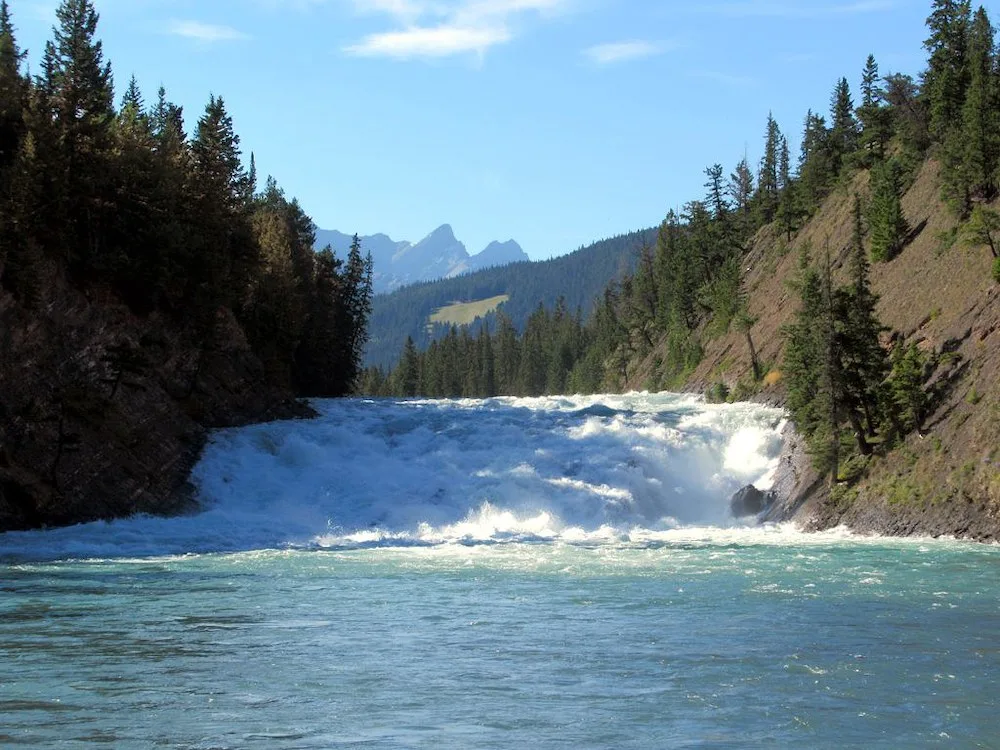
The trail head for these is at the same parking lot as Surprise Corner so it’s easy to do them both in the same day!
Johnston Canyon Trail to Lower Falls
Total Distance: 2.3 km out and back
Johnston canyon is one of the most beautiful and family friendly hikes you can do in the area.
In fact, hiking Johnston canyon in winter is one of the best winter activities to do in Banff. It’s incredible!
Most of the trails for the lower and upper falls at Johnston Canyon consist of catwalks built into the sides of the canyons which makes it a super unique hike.
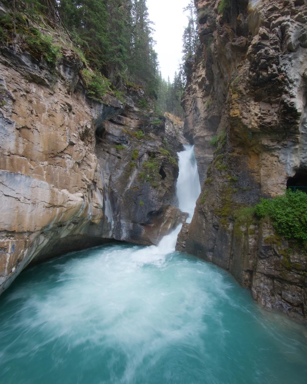
The trail to the lower falls is a fairly easy trail that’s good for the whole family.
It will take about 30 mins and you’ll get to see a pretty incredible views of the lower falls.
You’ll even get to walk through a misty rock tunnel before hitting the base of the falls.
If you are traveling with very small children, seniors, or people with low mobility you will probably want to stick to this trail alone
Johnston Canyon Upper Falls Trail
Total distance: 5.1 km out and back
The Upper Falls Trail at Johnston Canyon is about 2.5km each way and will take you uphill through the forest and out of the lower canyon to the top of the falls.
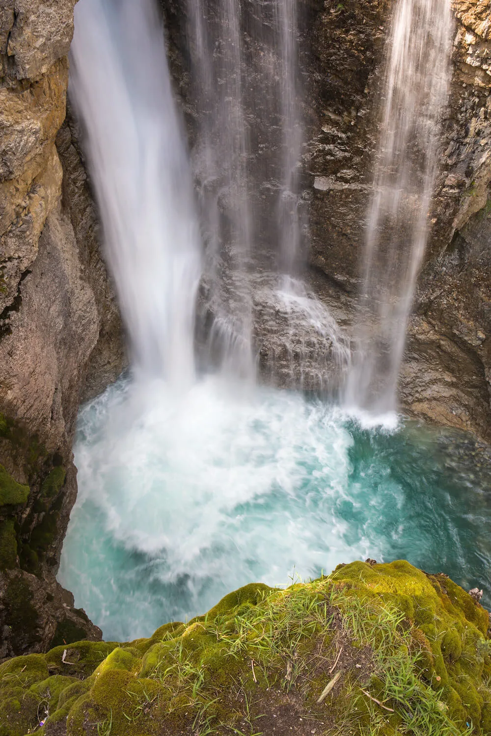
There are a couple different viewpoints along the Upper Falls Trail, the first being a long catwalk at the middl of the creek just about at water level.
There’s another viewpoint at the top of the falls too looking down which is incredible.
This trail is fairly easy although it is a constant incline.
It will take you about 1 hour to get to the top if traveling with children.
Two Jack Lake Trail
Total Distance: 3.2 km
The trail around Two Jack Lake is an easy enough hiking trail for all and features scenic views of the lake and surrounding mountains.
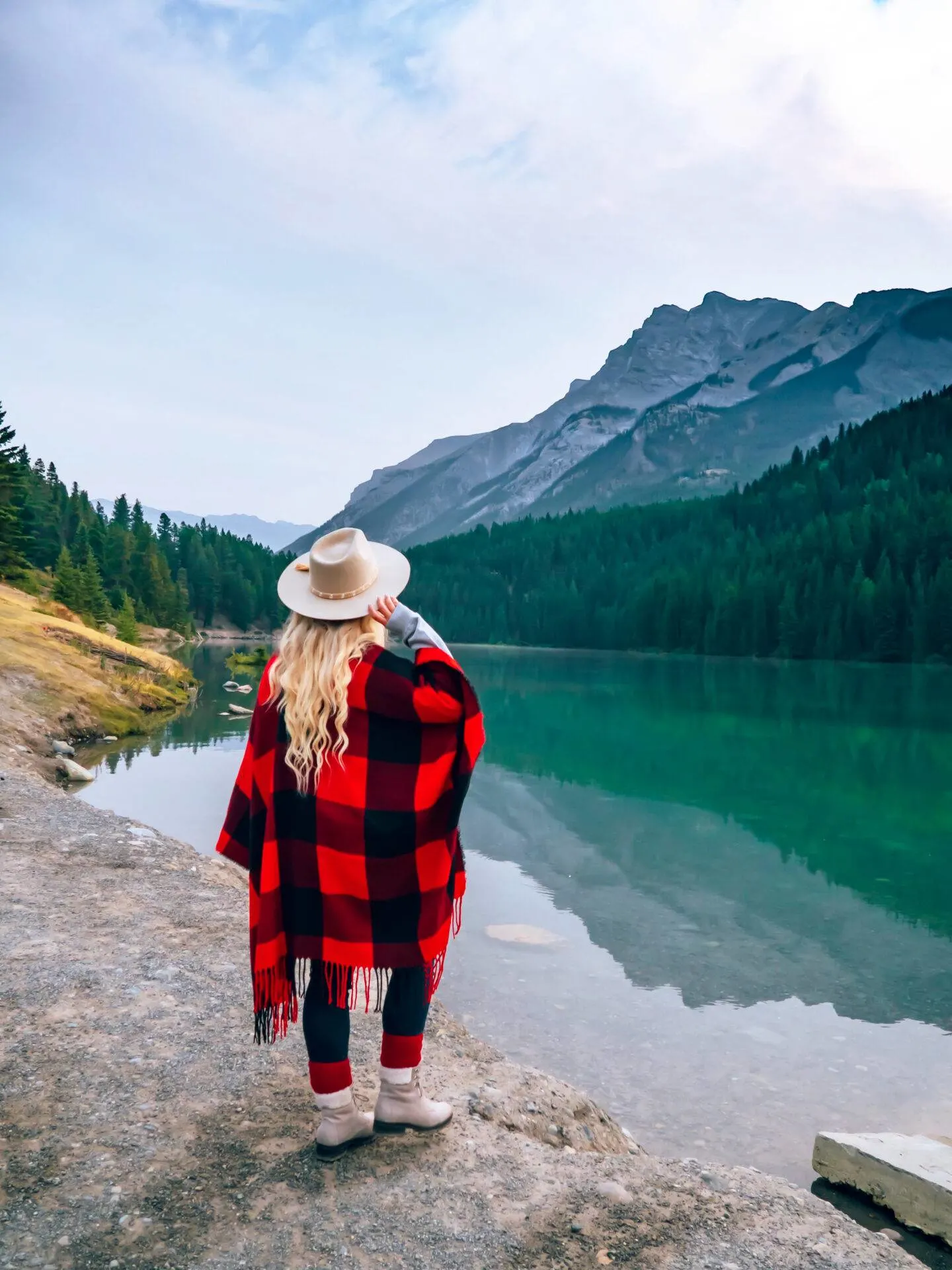
I definitely recommend trying to come here for sunrise and experiencing the beautiful area before it gets busy.
Best Moderate Hikes in Banff National Park
Ink Pots Trail (via Johnston Canyon)
Total distance: 11.7 km out and back (including Johnston Canyon)
If you want to get away from the crowds and see more of what Johnston Canyon has to offer then you have to do the Ink Pots trail!
The Ink Pots trail continues on for another 3km after the Upper Falls and will take you to some pretty incredible natural sights.
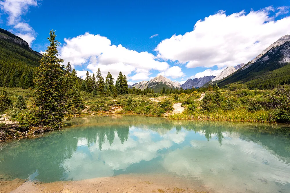
Along the Ink Pots trail you’ll get to see seven pools of emerald green mineral spring pools in a meadow that are absolutely stunning.
If you have the time I definitely recommend doing this trail, the color of these spring pools are incredible!
Hoodoos Trail
Total distance: 7.7 km out and back
The Hoodoos Trail is an extension of the Bow Falls trail and takes you on a 7.7 km adventure to see the Hoodoos of Banff.
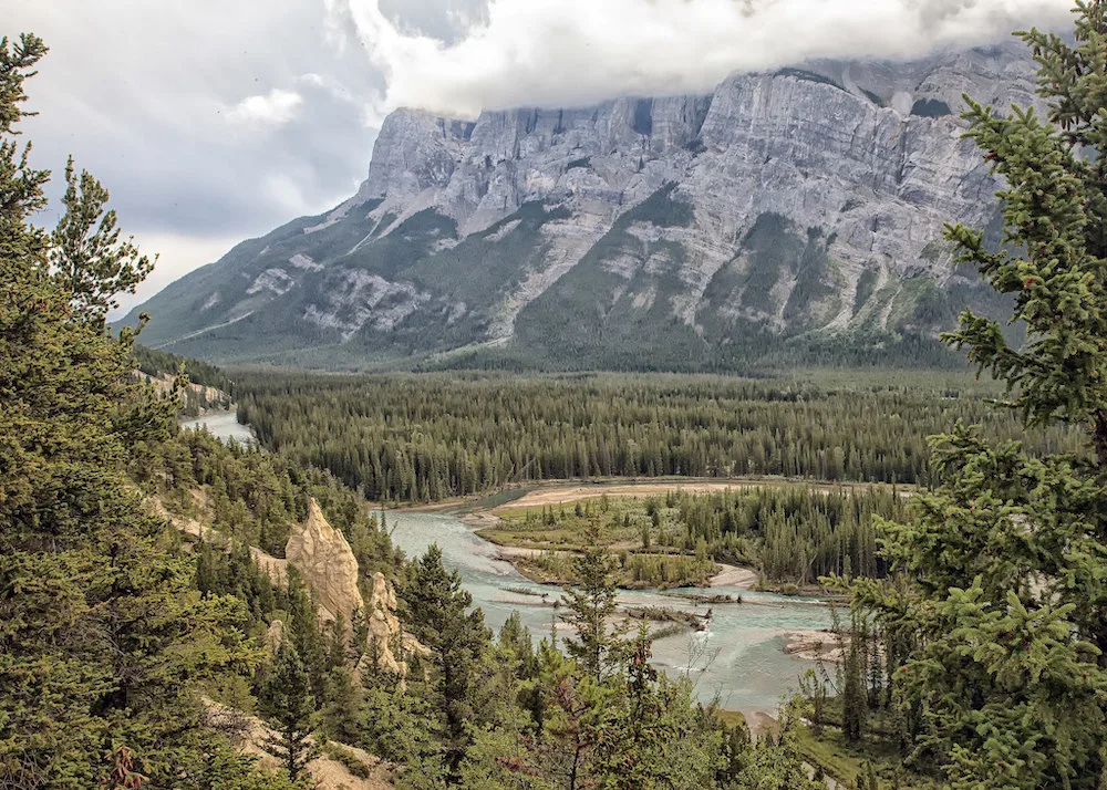
This hike is rated as moderate and you’ll get some breathtaking views of the Bow Valley along the way before getting to the Hoodoos which are natural sandstone structures.
Tunnel Mountain Trail
Total Distance: 4.5 km out and back
One of the most popular hikes near downtown Banff is the Tunnel Mountain trail.
Tunnel Mountain is located in the Bow River Valley and overlooks the hot springs of Sulphur Mountain.
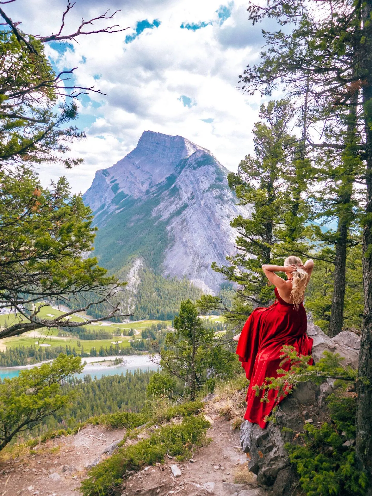
The mountain itself has a lot of significance in Banff’s history and to the indigenous people that used to live on the land.
The Stony People call the Tunnel Mountain “Sleeping Buffalo” because it looks like a sleeping buffalo!
The Tunnel Mountain Trail is a 4.5km (round trip) hike that’s considered moderate but is honestly easy enough for the whole family.
We saw plenty of families on the way up.
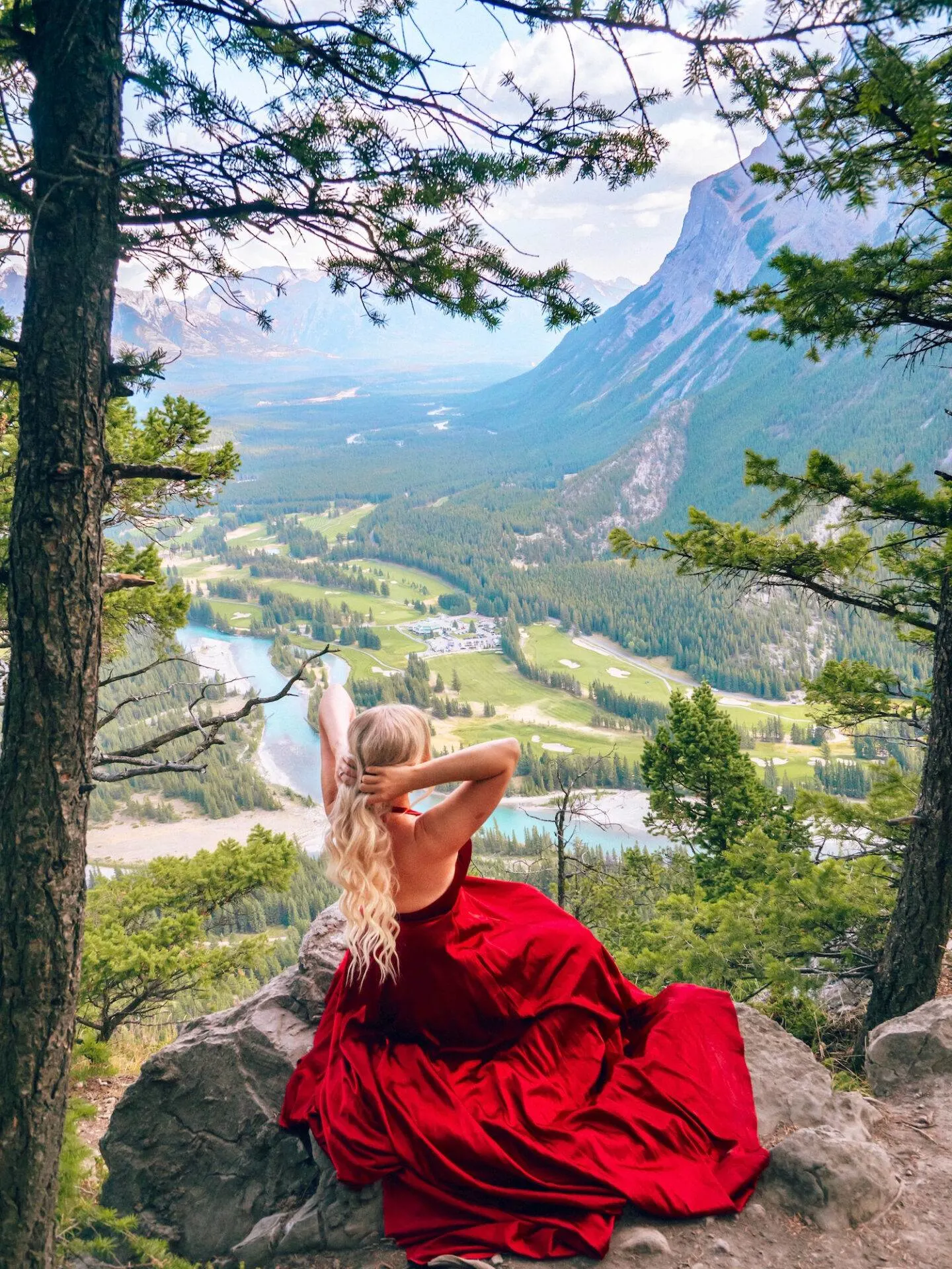
This hike is probably the easiest summit hike in the area and is the perfect opportunity to get in some incredible views without having to put in too much work.
Plus you can say you hiked a whole mountain!
Lake Agnes Tea House Trail
Total Distance: 7.8 km out and back
The Lake Agnes Tea hike is one of the most popular hikes in Banff National Park and is at the top of most people’s list when visiting the area.
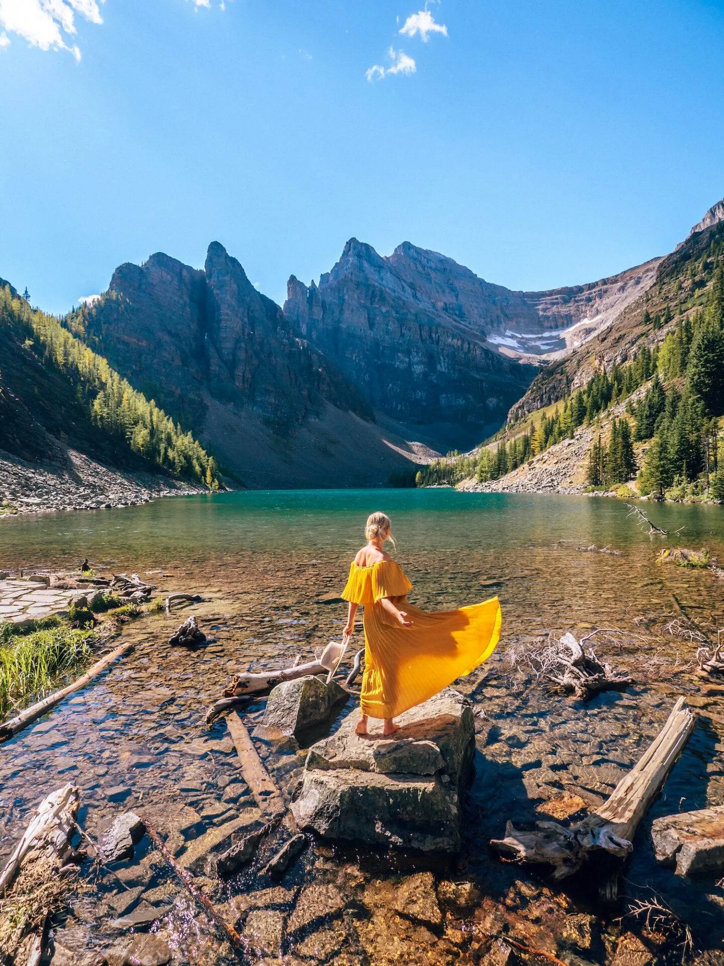
This hike is a 7.8km (round trip) heavily trafficked and moderate hiking trail that departs from the base of the lake.
The trail is uphill the whole way till you reach Lake Agnes Tea House, and you will gain 400m in elevation.
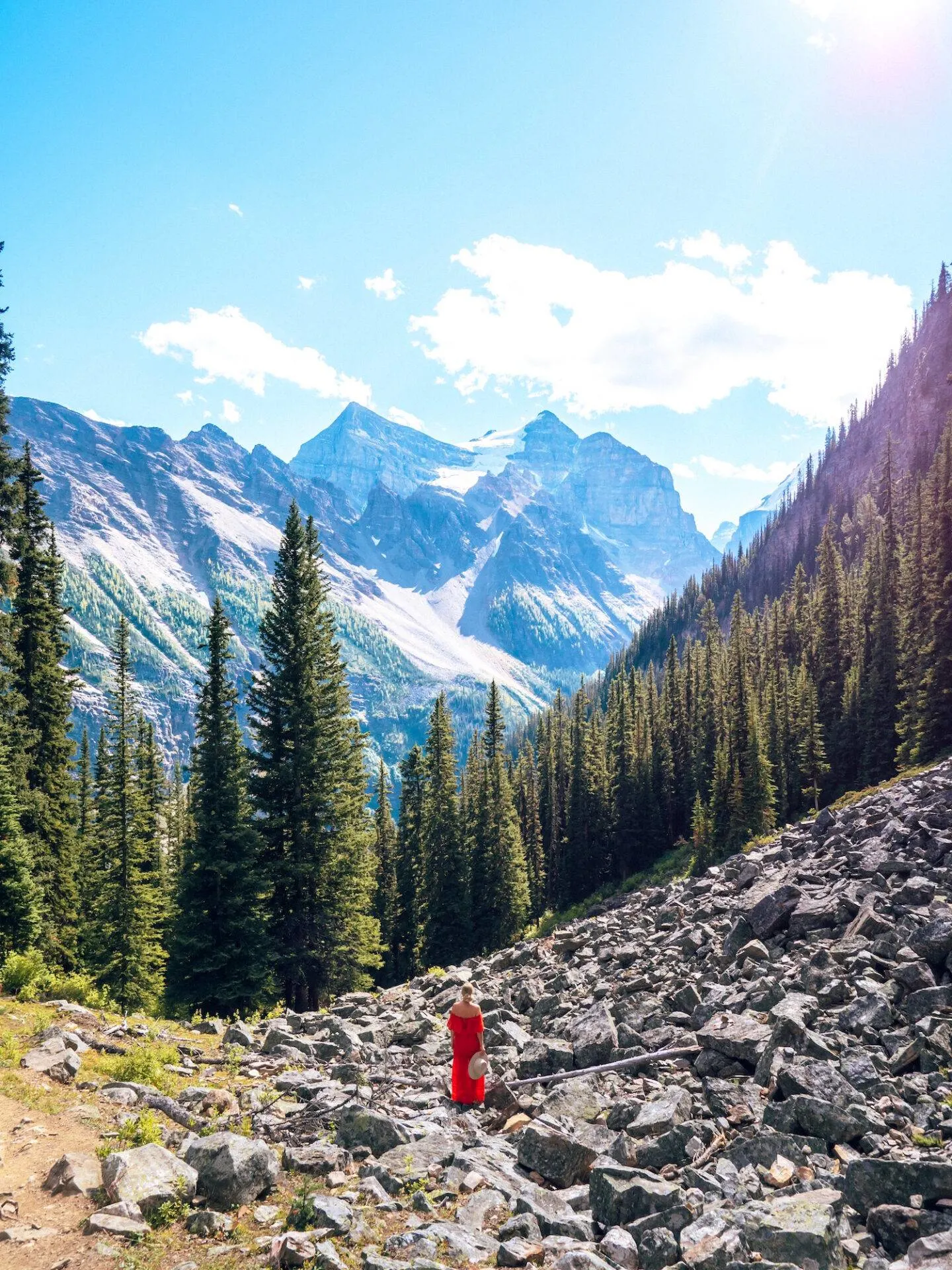
Over the course of the hike you’ll see a waterfall, mirror lake, as well as great view points of Lake Louise below you before reaching Lake Agnes and the tea house!
Most people stop at Lake Agnes so if you decide to continue along (on either little beehive, big beehive, or plain of six glaciers) you will be pleased to find the trails are less busy.
Little Beehive (via Lake Agnes Trail)
Total Distance: 9 km out and back (including the Lake Agnes portion)
The trail from Lake Agnes to Little Beehive is a short one, coming in at only 1km each way.
Once you reach the top of this hike you’ll get some incredible view of Lake Louise and the Chateau Lake Louise below.
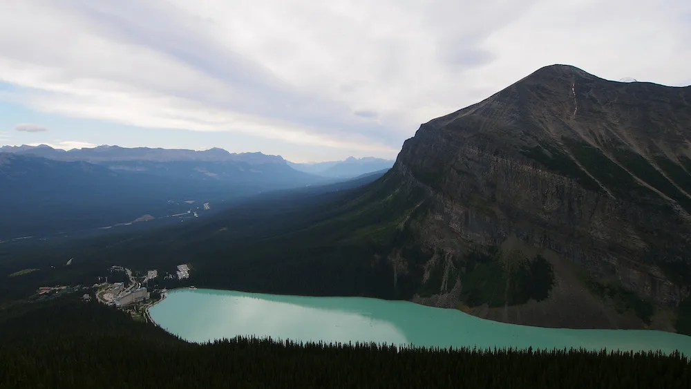
There is also a shortcut back down from Little Beehive to mirror lake that skips Lake Agnes and the Teahouse should you decide you want a quicker route back down.
Plain of Six Glaciers Trail
Total Distance: 14.6 km out and back (including Lake Agnes)
The Plain of Six Glaciers Trail also continues from Big Beehive and will take you to a second Tea House (the Plain of Six Glaciers Tea House) as well as close to the field of glaciers which is so neat!
It’s definitely a rare experience to be able to get this close to a glacier.
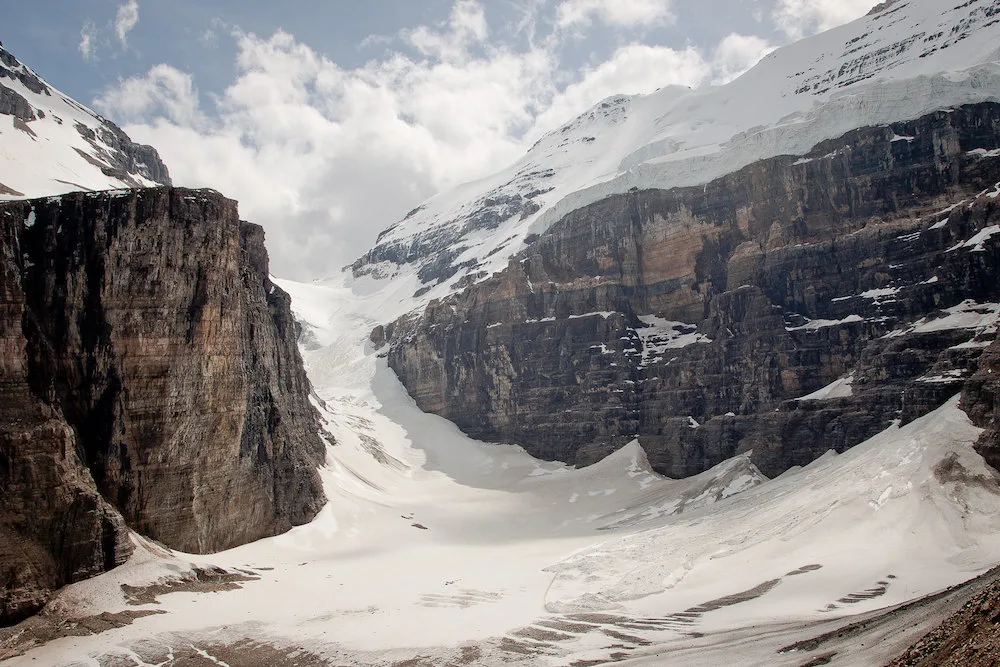
Overall the Plain of Six Glaciers hike is 14.6 km round trip (from the base of Lake Louise) but is considered moderate.
We didn’t get the chance to do this one but it’s definitely on my list for next time!
Sundance Canyon Trail
Total Distance: 10 km loop
Although I didn’t get the chance to do the Sundance Canyon trail myself this time, it was highly recommended to me by the Banff & Lake Louise Tourism board as another local favourite so I had to include it on the list.
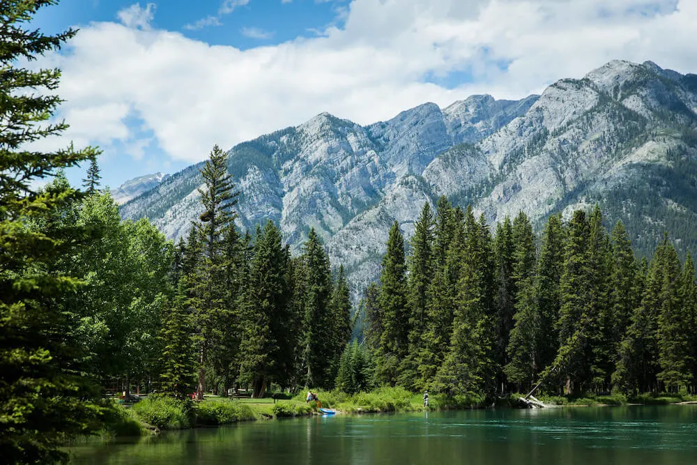
Sundance Canyon is a 10km heavily trafficked loop near the town of Banff that’s rated as moderate.
You’ll get to see some cascading falls, as well as a canyon and river along this trail.
A large part of the trail is paved too so it’s a nice easy one to follow. You can also do most of it by bike!
Best Difficult Hikes in Banff National Park
Big Beehive (via Lake Agnes Trail)
Total Distance: 10.9 km out and back (including the Lake Agnes portion)
The trail from Lake Agnes to Big Beehive is 1.6km long so it’s a little longer than Little Beehive but not too bad.
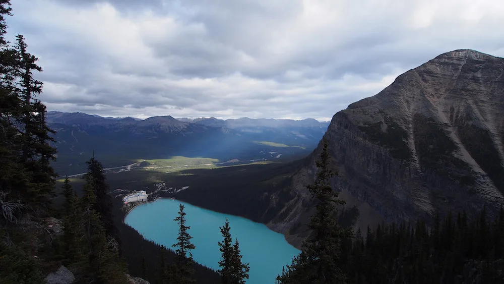
The view from Big Beehive is incredible and definitely worth the climb!
The only reason we didn’t do it is we had other plans later that day and didn’t have the time.
I would definitely like to go back and do the Big Beehive hike.
In case you’re wondering why it’s called Big Beehive, it’s because the mountain actually looks like a beehive!
And Little Beehive Mountain looks like a little beehive.
Best Hikes Near Banff National Park (Canmore & Kananaskis)
Although Canmore & Kananaskis aren’t technically in Banff National Park, they’re just a short drive away and it’s definitely worth visiting them while you’re in the area.
Both Canmore and Kananaskis have some amazing hikes. Here are some of my favourites!
Grassi Lakes Trail (Easy – Moderate)
Total distance: 4.3 km loop
The Grassi Lakes trail loop is a super popular 4.3km loop in Canmore.
Although the trail itself is rated as good for all skill levels on All Trails, there is a moderate/more difficult route or easier route that you can take.
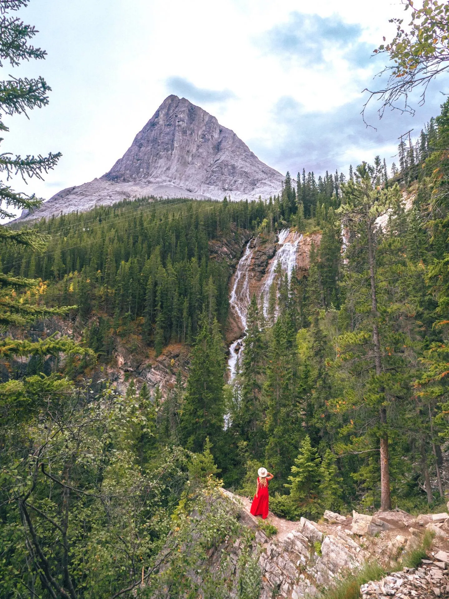
Personally I do not recommend the easier route on the way up as it has zero views.
It is a gradual incline through a forest up to the top but is very easy so it’s great for people with mobility issues.
The more difficult trail however has tons of viewpoints along the way and is a very scenic hike!

With the more difficult trail you’ll get incredible views of Canmore and the Bow Valley, as well as a great waterfall along the way.
It’s a really fun hike and the only challenge really is that it’s a constant uphill until you reach the lakes.
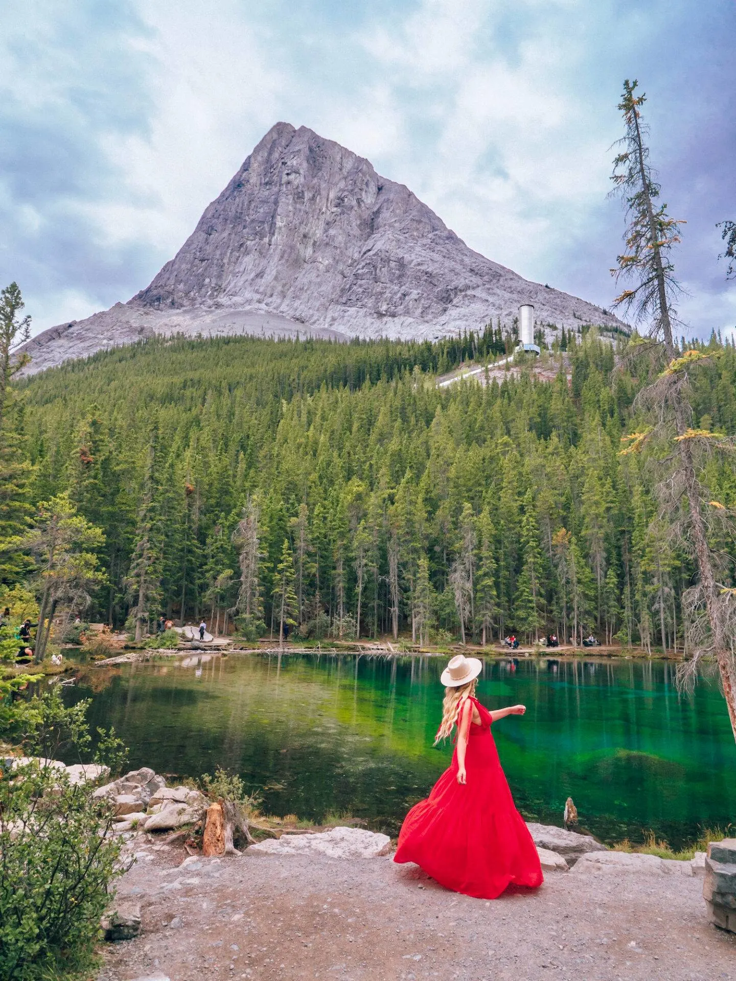
The Grassi Lakes themselves are two lakes (the upper and lower Grassi lakes) that lie at an elevation of 1512m above the town of Canmore.
The lakes themselves are absolutely stunning and have a green & turquoise jewel tone to them that’s pretty incredible to see in person.
Bow River Loop (Easy)
Total distance: 2.1 km loop
The Bow River Loop trail is a relaxing and scenic walk through the woods that’s perfect for all skill levels.
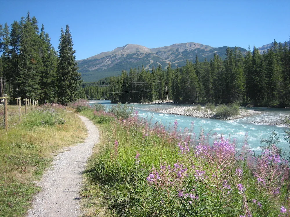
At only 2.1km long it’s an easy afternoon activity that doesn’t take much of a commitment.
Along the way you’ll get some great views of the surrounding mountains as well as the Bow River.
East End of Rundle (Difficult)
Total distance: 5.6 km out and back
East End of Rundle is an incredibly scenic scramble of a hike that takes you to the top of Mount Rundle.
There are some seriously incredible viewpoints both along the way and at the summit.
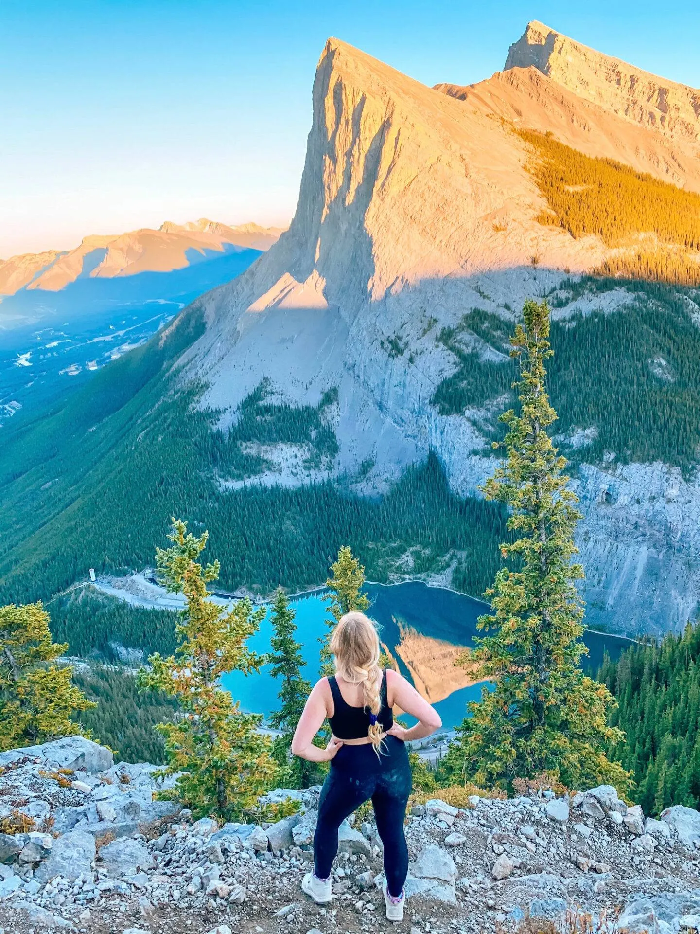
This hike is rated as difficult and is a pretty steep and strenuous hike, but if you’re up to it you will be rewarded with these incredible views.
This hike requires proper equipment in terms of hiking boots (and I highly recommend poles as well).
Although the hike itself is only 5.6km, it is uphill the whole time and takes a good 5-6 hours.
Most of the hike is a scramble with some parts being quite steep and slippery.
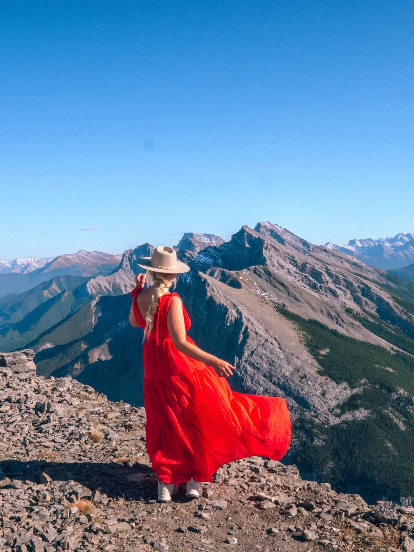
For this hike I highly recommend downloading the All Trails app as the trail is not well marked and it’s easier to find your way with the in-app map.
This app is great to have especially when doing hikes in no service areas as you can download the maps in advance and follow along!
Ha Ling Peak
Total Distance: 7.2 km out and back
Ha Ling Peak is the pointy mountain you can see from the first viewpoint on East End of Rundle I shared above and it’s pretty incredible!
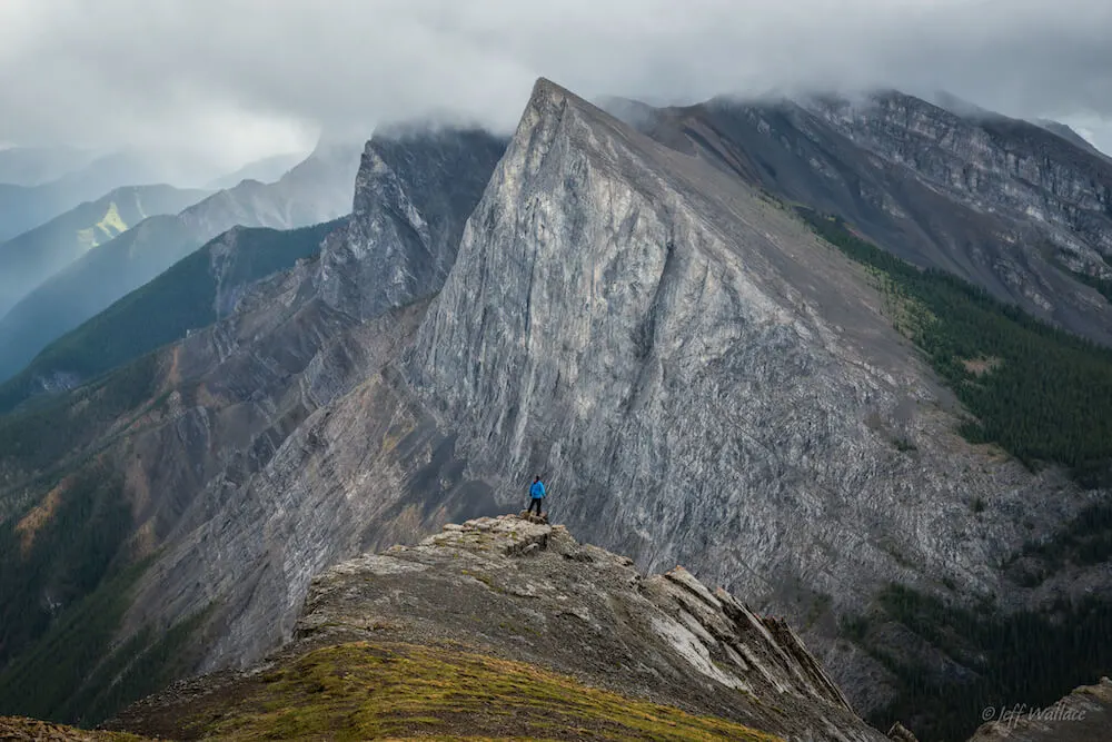
The Ha Link Peak hike is a 7.9km heavily trafficked trail that’s rated as difficult.
I am told it’s not as difficult as East End of Rundle though.
Although this trail is difficult it’s mainly because it’s a steady climb. You will not encounter scrambles here.
Final Thoughts
Banff is such an incredible place and there really are so many incredible hikes in this area.
No matter what skill level you are, there’s a hike on this list of the best hikes in Banff National Park for you.
Which Banff hike are you most excited to do?
By the way, if you’re visiting the Canadian rockies soon don’t forget to check out these posts:
- 50 Best Things to do in Banff National Park
- The Ultimate Guide to Hiking Johnston Canyon in Winter
- 28 Awesome Things to do in Banff in Winter
- The Best Restaurants in Banff
- 11 Best Hikes in Jasper National Park
- 23 Best Things to do in Jasper National Park

Be sure to keep up with me on Instagram, Pinterest, TikTok and Facebook if you aren’t already!
Feel free to subscribe to my weekly newsletter to get my blog posts, updates, and special offers delivered right to your inbox 🙂

